Jin Lab - Remote Sensing and Ecosystem Change
  • Home
  • About
    • Lab
    • Opportunities
  • Research
    • Projects
    • Themes
      • Remote Sensing Algorithms
      • Ecological Dynamics
      • Wildland Fires
      • Precision Agriculture
      • Geospatial Technology
    • Publications
    • Data and Tools
  • People
    • Current members
    • Principle Investigator
    • Alumni
  • Data
  • Teaching
  • Outreach
    • California Space Grant
    • California View
  • News
Home > ResearchThemesGeospatial Technology

Geospatial Technology

Big data, geospatial analysis, interactive webGIS mapping,
and Google Earth Engine applications

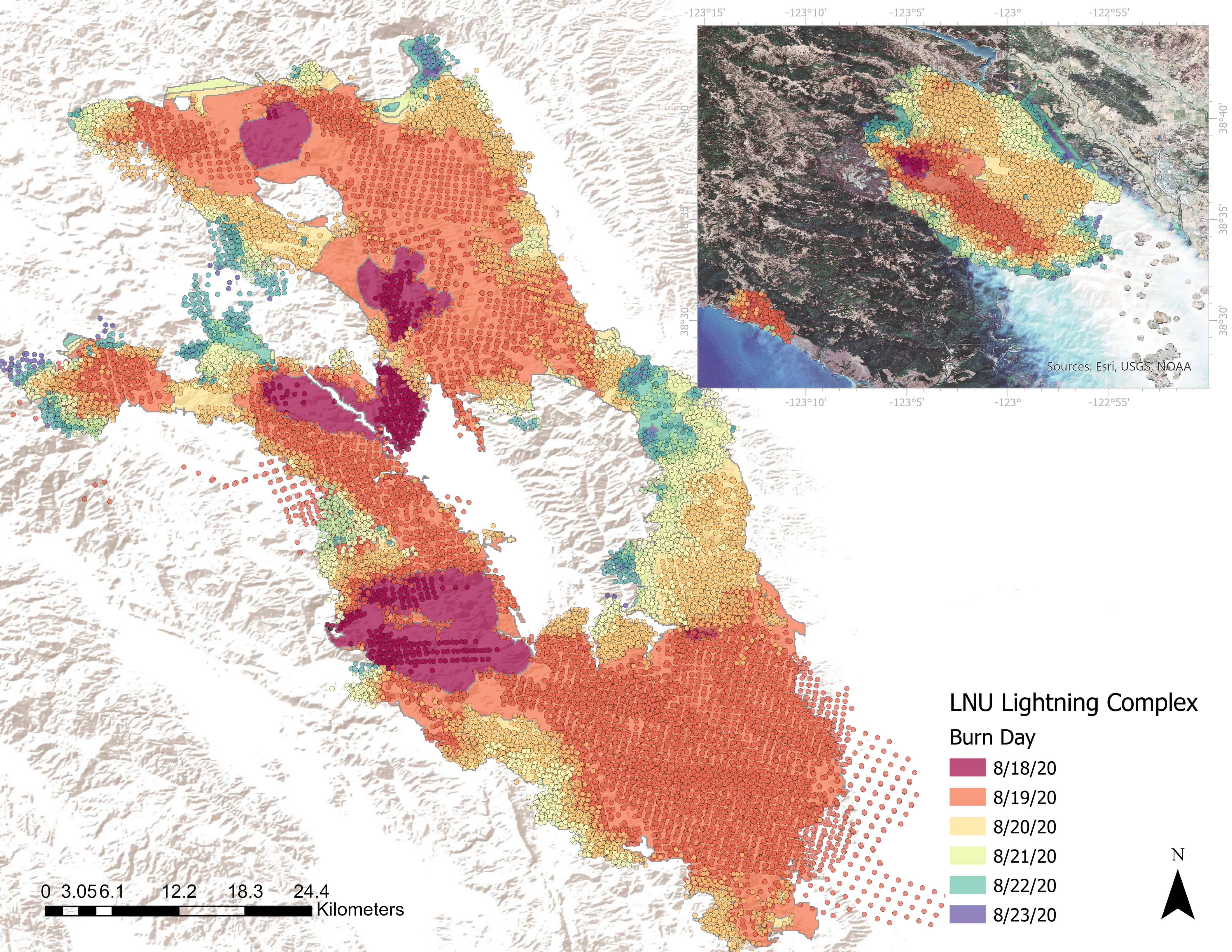
LNU fire progression from VIIRS and MODIS observations

Click here for animation

LNU_08232020.cd539a98.jpg

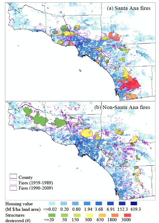
Structure damages for Southern California wildfires

Structures_SCA.png


Research

  • Projects
  • Themes
    • Remote Sensing Algorithms
    • Ecological Dynamics
    • Wildland Fires
    • Precision Agriculture
    • Geospatial Technology
  • Publications
  • Data and Tools
Department of Land, Air and Water Resources UC Davis
College of Agricultural and Environmental Sciences
Jin Lab - Remote Sensing and Ecosystem Change. Department of Land, Air and Water Resources. All rights reserved.