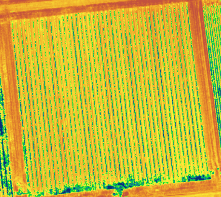
Precision Agriculture
a) monitoring crop growth and yield;
b) detecting crop stress and disease;
c) quantifying consumptive water use.
Our monitoring capabilities will provide the farmers timely and spatially explicit crop information, help them to tailor their use of water, fertizers, and chemicals based on how much is needed and thus to optimize crop yields while minimizing water and nutrient inputs.
AI-driven yield prediction
Agricultural productivity is subject to many stressors, including abiotic and biotic threats many of which are exacerbated by a changing climate, thereby affecting long-term sustainability. To understand and mitigate these threats will require the collection of large data sets on crop productivity and the associated biotic, abiotic and agronomic factors and an advanced big data approach.
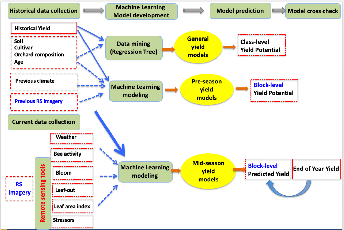
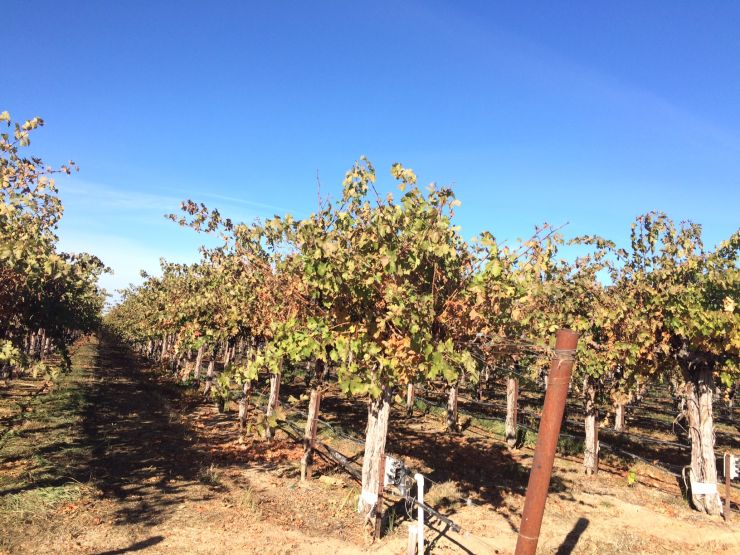
The yield of tree crops, such as almond orchards, is particularly complex, and advanced analytics is required to integrate these highly heterogeneous datasets to generate insights to understand the constraints on the yields at tree and field scales. Here we used machine learning approaches to investigate the determinants of almond yield variation in California’s almond orchards. Statistical models were also built to predict orchard level yield in the early and mid-seasons, by integrating the remote sensing metrics and weather data.
Related Publications:
Jin , Y. B. Chen, B. Lampinen, and P. Brown (2020), Advancing Agricultural Production with Machine Learning Analytics: Yield Determinants for California’s Almond Orchards, Frontiers in Plant Science, 11, 290, 10.3389/fpls.2020.00290.
Zhang, Zhou, B. Chen, Y. Jin, and P. Brown (2019), California Almond Yield Prediction at the Orchard Level with a Machine Learning Approach, Frontiers in Plant Science, 18, 10.3389/fpls.2019.00809. [PDF]
High throughput phenotyping
Traditional plant phenotyping with in situ measurement is labor-intensive. Our goal is to develop test high throughput phenotyping approaches and workflow using the UAV imagining coupled with the state of art machine learning technology. For example, we have recently captured the hourly flowering dynamics of different varieties of lettuce across the whole experiment field, with a MicaSense RedEdge multi-spectral camera mounted on a DJI Matrices100 drone. The support vector machine machine learning algorithm was developed to map the floral pixels from the centimeter multipsectral imagery.
Related Publications:
Han, R., A. J.Y. Wong, Z. Tang, M. J. Truco, D. O. Lavelle, A. Kozik, Y. Jin, and R. W. Michelmore (2020), Drone phenotyping and machine learning enable discovery of genetic loci regulating daily floral opening time in lettuce,Detecting drought-induced tree mortality in Sierra Nevada forests with time series of satellite data, Plant Physiology, submitted.
Multi-sensor plant stressors/plant health monitoring